
Sources Around Tempe Neighbors
No single public file lists every person on a Tempe block. The best official starting point is parcel geography because its units are fixed and can be checked. The assessor names the indexed owner, the Recorder confirms deed parties, and Tempe adds address-linked projects and association boundaries. Voter data is governed by strict request and use rules. Historical reverse directories show a past block only for their publication year.
| Source | What It Shows About a Block | Access |
|---|---|---|
| Maricopa parcel GIS | Adjacent parcel shapes, owners, situs and mailing addresses, APNs | Free viewer and export; owner is not occupant |
| Assessor and Recorder | Property identity, current roll, deed parties, and chain | Free index and unofficial image; official copies paid |
| Arizona voter data | Fields authorized by law for registered voters | Personal lookup or restricted county-file request |
| Tempe permit and code records | Address-linked projects, cases, and project participants | Online search and city request channels |
| Neighborhood association GIS | Public group name and boundary | Public geometry and contacts; no member roster |
| Historical reverse directories | Dated address-to-householder entries | Library, Museum, or State Library; year gaps |
Use the parcel source to define the block. Then choose the record that answers the next question. An owner name belongs to a parcel record. A permit contact belongs to a project. An association boundary describes a civic area. None of these facts alone proves who lives nearby today.
Map a Tempe Neighbor Block
The Maricopa County Assessor Parcel Viewer can move from one address to a repeatable group of nearby parcels. Search the address, accept its autocomplete suggestion, and click the parcel polygon below the point. Each parcel can link to property information, sketch, aerial imagery, Street View, and tax summary. Preserve the assessor parcel number, or APN, because it identifies the lot more reliably than a displayed label.
- Find the known address and select the parcel under the result point.
- Click adjoining polygons one by one for only the immediate lots, or open Search By and choose Buffer Something.
- Set the distance and unit, then choose Entirely within the Buffer or Within or touching the Buffer.
- Add or remove parcels, use Measure to document the boundary, and review the attribute table.
- Export CSV or GeoJSON and save the shareable search URL so the same Tempe neighbor area can be checked again.
A broad selection can exceed the viewer's 1,000-result cap. Keep the shape to the immediate block or divide it into small parts. For a complete named-road chain, use the Tempe street directory method instead.
Choose Tempe Neighbor Parcels Precisely
The buffer option hides an important choice. Entirely within includes only parcels fully enclosed by the search zone. Within or touching also picks parcels that cross its edge. The latter often fits a block-radius check because large corner lots are less likely to vanish. Record the distance, unit, rule, and source date so another person can reproduce the selection.
Mouse tools also support point, line, polyline, freehand line, polygon, and freehand polygon. A line along one side of a street can isolate facing parcels. Add and remove controls refine the result. Exports can include JSON, GeoJSON, the attribute table, or CSV. These tools make the county viewer more useful than a static map for understanding nearby property patterns.
Open the official Parcel Viewer help before using its buffer controls.
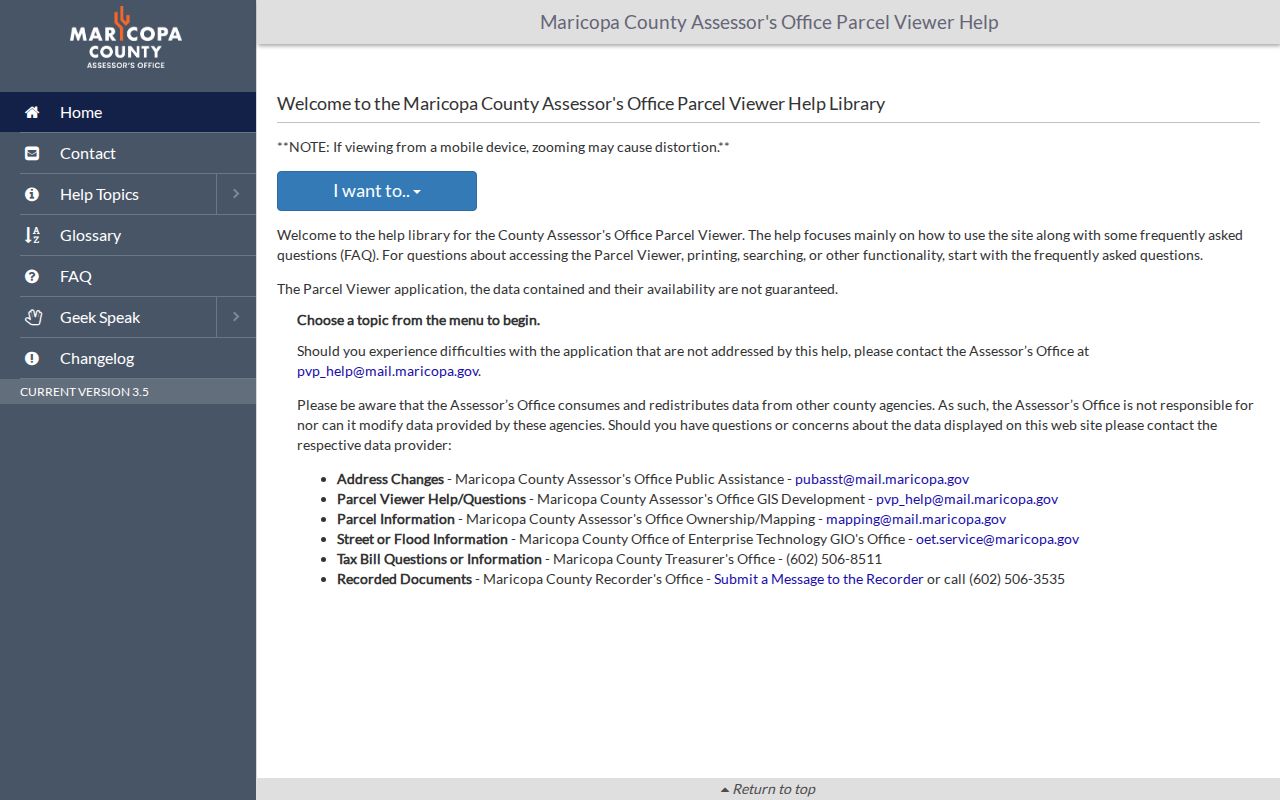
The help screen documents how selection, buffer, feature review, and export work, which makes a saved block result easier to explain and repeat.
Read Tempe Neighbor Parcels
The county parcel record separates physical and mailing addresses component by component. It also exposes owner name, APN, subdivision, MCR number, deed number and date, sale date and price, land size, and links to valuation, sketch, and tax details. Situs means the physical property address. Mailing is where the owner receives notices. A mismatch may suggest an owner lives elsewhere, but it says nothing about the people at the property.
- Parcel
- A mapped tract of land identified by an assessor parcel number.
- Situs address
- The physical address attached to the parcel.
- Mailing address
- The destination used for owner correspondence, which can differ from the property.
- MCR number
- A Maricopa County map reference used with subdivision and plat records.
Open the deed number in the Maricopa County Recorded Document Search when ownership needs confirmation. Record grantor, grantee, instrument type, date, document number, and legal description. A deed party is tied to that filing. It is not a list of all people living on the parcel.
Tempe Neighborhood Contact Layer
Tempe residential associations are voluntary and usually cover about 40 to 400 households. Dues are optional, and each group holds an annual meeting and elections. The city can duplicate and mail a qualifying newsletter to all households inside a boundary. That mailing service does not disclose the list or turn newsletter delivery into proof of membership.
The Tempe Neighborhood Services association page supplies the official map route and public contacts. City GIS exposes Affiliate Association and Residential Association polygons with group names, not resident names. This layer can tell whether an address lies in a civic area and where to find public meeting or newsletter information.
Neighborhood Services
480-350-8234
neighborhoods@tempe.gov
Association rules, map route, and city newsletter support.
Central and North Tempe
Publicly named channels include Maple Ash, Riverside, University Park, Clark Park, Escalante, and Hudson Manor.
South Tempe
Publicly named channels include Warner Ranch HOA, Optimist Park Southeast, Alta Mira, Camelot Village, and Estate LaColina.
These are examples of public community channels, not verified neighbor directories. Use the official boundary and association contact rather than assuming every nearby household joined.
Tempe Address Records Add Context
The Tempe Accela building portal searches by street number, direction, name, type, unit, parcel, lot, city, state, ZIP, record number, project, professional, and date. It can connect a nearby property with permits and project roles. Planning entries before April 2015 may be incomplete, and a contractor, applicant, or inspector is not thereby a resident.
The live Tempe code violation map adds status, violation, inspector, and case number. Closed cases remain for only two weeks, so preserve a date and case number when the information matters. Written Community Development requests can seek property cards, address histories, inspections, and other retained files. The office states an average twenty-business-day process and accepts online, kiosk, mail, and counter requests.
Note: A permit or code record describes a property event, not everyone on the block.
Arizona Voter Rules for Neighbors
My.Arizona.Vote is a personal verification portal, not a browseable Tempe neighbor roll. It uses county and identifying details to reach registration and election information. Arizona law allows specified public voter-file fields, including name, party preference, registration date, residence and different mailing address, ZIP, a supplied phone, birth year, a supplied occupation, and participation history. Participation shows which elections a voter took part in, never the choices marked on a ballot.
A county voter-file request is not a free public download. Requests may go by portal or email, fax, mail, or appointment-based counter inspection. Fees begin at $93.75, and output may be TXT, CSV, XLS, or PDF. Secure delivery uses separate password and link emails, and the link expires after two weeks. The office will not create a custom data manipulation.
A.R.S. § 16-168 limits authorized purposes and bars commercial use and internet posting. A.R.S. § 16-153 protects eligible voters and Address Confidentiality Program participants. Month and day of birth, government ID numbers, signature, email, and protected-voter information are withheld. A voter file cannot lawfully become an unrestricted block directory.
Tempe Neighbor Records Versus Compilations
Commercial neighbor tools blend government and commercial material. They can lag moves, merge people who share a name, and hide the source date. An official record is narrower but clearer about what it proves. Use each source at its stated scope, then verify high-stakes facts with the custodian.
| Feature | Official Tempe or County Source | Commercial Compilation |
|---|---|---|
| Source trail | Named custodian, parcel, document, or case | Often blended or unclear |
| Meaning | Defined field such as indexed owner or permit contact | May imply a current person without context |
| Correction | Go to the office that created the record | Separate opt-out or correction process |
| Block use | Parcel selection is repeatable and dated | Coverage and update date may be uncertain |
For block curiosity, county parcel polygons and Tempe association boundaries give a sound geographic base. Add deeds, permits, or historical sources only when they answer a specific question. Do not treat a compiled profile as proof that a person is your current neighbor.
Past Tempe Neighbors Need Dates
Historical reverse directories can turn an old address into a dated householder. The verified 1968 Polk Mesa-Tempe volume advertises a complete street and avenue guide for households and business-space occupants. The 1925 Tempe section uses rural routes instead; that volume's householder street guide is for Phoenix. Search the right structure for the right year.
Pair a directory entry with a census year, parcel identity, plat, or Sanborn footprint. Tempe maps exist from 1890 forward, and official property files document individual former addresses. This guards against treating a changed number or demolished building as a vanished person. The result is a snapshot of past Tempe neighbors, not a current block list.
Privacy Around Tempe Neighbors
Parcel owners are not everyone nearby. Renters and household members are absent from the assessor roll, a trust can stand in place of a person, and a mailing address can point elsewhere. Utility, delivery, and motor-vehicle customer data are not open neighborhood lists. Protected voter data and records tied to Arizona's Address Confidentiality Program can properly disappear from routine searches.
Arizona's program gives eligible survivors a substitute address and forwards qualifying mail. Certification lasts five years and begins with a registered Application Assistant. Its purpose is to prevent routine public records from exposing a survivor's home. A no-result can therefore reflect a protection, a lag, a name variant, or a source that never indexed the occupant.
If an official portal fails, use the documented access chain: assessor history by email, Recorder counter and staff, Tempe Community Development requests, Neighborhood Services contacts, or library and Museum research for older blocks. Ask for an existing record by address, APN, type, and date range. Do not ask an office to create a new neighbor roster.
Lawful use. Tempe neighbor lookups support civic curiosity, community contact, and personal safety. Never use public records to follow, surveil, harass, intimidate, or harm another person.